

Chart 100 - North Atlantic Ocean Passage Chart - carte marine papier


Echelle 1 : 7 620 000
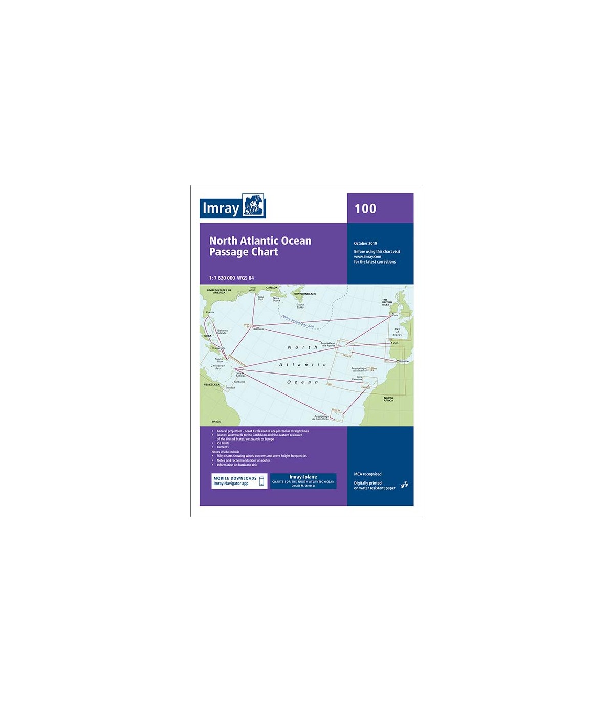
Carte routière atlantique Nord, du Brésil à Terre Neuve et de Gibraltar aux Antilles.
38,00 €
TTC
Aimer0
At a scale of 1:7,620,000 this chart covers the North Atlantic from Brazil to Newfoundland and Gibraltar to the Caribbean. It has been constructed on a conical projection that means that Great Circle tracks can be plotted as straight lines rather than curves.
The chart shows the main trend of contours, limits of ice, magnetic variations and keys routes as identified by DM Street. On the reverse are notes on the routes and small wind rose charts, with accompanying charts showing excessive wave heights and storm frequencies for the months that yachts cross the Atlantic: April to July and September to December.